
Welcome

Urban & Regional Intelligence
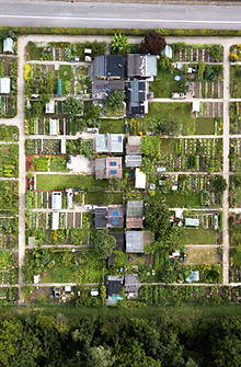
Data-powered solutions for healthy, resilient, and inclusive cities.
We turn territorial complexity into actionable intelligence. Our tools help governments anticipate risks, plan for healthy and resilient growth, and align urban development with climate, mobility, housing, and economic priorities.
Urban & Regional Intelligence includes four interconnected pillars
GeoAdaptive delivers data-driven strategies that help cities and regions grow healthier, more resilient, and more inclusive.
We integrate geospatial intelligence, health-oriented indicators, climate analytics, and urban finance tools to support governments in navigating rapid urbanization, climate risks, and infrastructure pressures.
Our portfolio spans over 20 years of experience across Latin America, Africa, Asia, and North America, supporting national and subnational actors with solutions that translate data into decisions, strengthening governance, optimizing investments, and improving daily life in cities.

Urban & Regional Intelligence


Areas of Expertise
GeoAdaptive’s Urban & Regional Intelligence practice integrates spatial data, digital systems, and climate-smart planning to help cities shape healthier and more resilient futures. Our four interconnected pillars convert complex urban challenges into clear, data-driven strategies that guide long-term territorial transformation.

Healthy Urban Growth
We help cities grow smarter, with cleaner air, safer streets, and healthier communities. By combining land-use intelligence, mobility insights, green infrastructure, and urban health data, we guide governments toward low-emission, walkable, and equitable urban expansion. Our geospatial and risk-based tools turn growth pressures into strategic opportunities for well-being, resilience, and long-term prosperity.
Specific services, among others, include
-
Healthy urban expansion and land-use optimization
-
Informal settlement upgrading with health & safety co-benefits
-
Green corridors, nature-based solutions, and urban cooling strategies
-
Housing and land-use forecasts informed by health and climate metrics
Digital Urban Intelligence
We turn urban data into real-time decision power. Through geospatial platforms, digital twins, mobility and health analytics, and interoperable data systems, we help cities monitor, predict, and manage change with precision. Our digital frameworks strengthen institutions with transparent, resilient, and accountable urban management, unlocking smarter, faster, and more equitable governance.
Specific services, among others, include
-
Urban Intelligence Platforms & dashboards
-
Urban Health Intelligence (UHI) dashboards & indicators.
-
Open data architecture and data governance frameworks.
-
Predictive analytics for mobility, environment, and service delivery
Urban Climate Finance
We help cities turn climate ambition into investable action. Through spatial economics and innovative finance tools, blended finance, resilience bonds, and land value capture, we unlock capital for low-carbon, health-positive, and resilient infrastructure. Our frameworks maximize impact per dollar and strengthen long-term urban resilience.
Specific services, among others, include
-
Infrastructure prioritization & spatial investment planning
-
Climate and health co-benefit valuation for projects
-
Blended finance structures for resilient urban development
-
Climate finance roadmaps & catalytic investment portfolios
Inclusive Urban Governance
We strengthen institutions to lead healthier, more resilient, and inclusive urban transformation. Through capacity building in data-driven planning, climate-ready governance, and cross-sector coordination, we integrate digital tools, fiscal strategies, and urban health frameworks to help governments adopt adaptive, transparent, and equitable systems that respond to evolving pressures.
Specific services, among others, include
-
Training in data-driven & health-informed urban planning
-
Institutional diagnostics & capacity-building
-
Land-based finance & municipal revenue strategies
-
Institutional foresight labs for long-term, climate-ready governance.
Core Domains of expertise
We integrate data, spatial foresight, and institutional capacity to build resilient and inclusive territories.
These eight domains guide how we support cities with comprehensive, future-ready strategies.
.png)
01. Spatial Economic Intelligence & Market Studies
.png)
05. Smart City & Digital Urban Systems
.png)
02. Scenario-Based Growth & Land-Use Modeling
.png)
06. Economic Impact & Cost-Benefit Analysis
.png)
03. Infrastructure & Capital-Project Prioritization
.png)
07. Stakeholder Engagement & Participatory Planning
.png)
04. Climate-Risk & Resilience Urban and Regional Analytics
.png)
08. Capacity Building & Institutional Strengthening
Related Projects

Experimenting Pathways for Amazonian Cities: Data-Driven Tools for Healthier and More Resilient Urban Futures
Developed in collaboration with the Inter-American Development Bank (IDB) and the IDB Cities Lab, this initiative supports Belém (Brazil), San José del Guaviare (Colombia), and other Amazonian cities in strengthening resilience through automated, geospatial intelligence. The project deploys machine-learning tools, such as urban tree canopy detection, land-use change monitoring, and emissions estimation, to generate rapid, high-quality data for territorial planning.
By integrating satellite analytics, local inputs, and environmental indicators, the tools reveal urban health dynamics including heat exposure, green infrastructure access, and air-quality risks. These insights help governments prioritize nature-based solutions, guide low-carbon growth, and design policies that enhance well-being in vulnerable communities.
The project establishes a replicable framework for Amazonian cities, linking environmental preservation, digital innovation, and healthier urban development.

Urban Governance, Resilience Planning & Institutional Strengthening for Nepal Municipalities, (Covid-19)
In the project, we developed geospatial and municipal finance baselines to assess disaster risk profiles and service delivery capacity. We assessed the impact of COVID-19 on the municipalities and derived municipal risk profiles and urban planning priorities based on a desk review of ongoing initiatives, municipal development plans, and geospatial analysis. We recommended pathways for risk-sensitive land-use planning, resilient building standards, and increased risk awareness.
We assessed the nine municipalities using the criteria and indicators of the Ready2Respond Diagnostic Framework. We held workshops with stakeholders to validate the assessments. The recommendations stem from strategies and investments to improve emergency preparedness and response capacity across five dimensions. GeoAdaptive identified municipal typologies to organize recommendations into nine municipalities, which could be typologically expanded to 293 urban municipalities.
.png)
Strategic Urban Resilience & Territorial Intelligence for Greater Santiago, Chile.
This regional and community planning project seeks to prepare the municipalities of the Santiago metropolitan region to respond to threats from climate change and other anthropic stresses. The project is situated within a process of climate planning and action for the Santiago Metropolitan Region, providing key inputs that will guide the process.
The study includes the modeling of threats of climatic origin (flood, landslides, drought, forest fires and heat waves), analysis of population exposure and infrastructure, vulnerability analysis and risk assessment for the region, both in areas urban as well as rural. As part of the climate planning and action process, territorial indicators of adaptive capacity were developed to assess and monitor the effectiveness of the actions implemented.
.jpg)
Scenario-Based Urban Futures & Coastal Resilience Pathways for the Marshall Islands
In this project, a series of scenario models with different levels of sea level rise and storm surge flooding were carried out to understand the level of impacts and what adaptive measures could be considered. This study used Dynamic Adaptive Policy Pathways to suggest adaptation strategies capable of responding to climate-related uncertainties. The specific conditions of the urban atolls Majuro and Ebeye, where 76% of people live, were addressed with several pathways combining nature-based solutions and gray infrastructure.
GeoAdaptive also has ample project experience responding to a broad set of environmental and climate-related hazards, including inundation, sea level rise, storm surge, high winds, seismic events, and landslides.
.jpg)
Nature-Based Solutions & Resilience Frameworks for Florida, USA.
Given the diverse land-ocean interface and varying levels of vulnerability and adaptability, the project categorized four influential coastal typologies: wetland, ocean, bay, and estuarine. For each typology, the project formulated a set of toolkits with different interventions taking into account nature-based solutions to enhance the process of creating a more resilient and sustainable coastal region. Four main actions are identified and located: Protect, Restore, Enhance, and (De)Construct.
This study also classified Florida’s coastline into 9 regions using a taxonomic approach built from ecosystem attributes and built-up area densities. These classes provided a qualitative framework to localize causes and solutions to vulnerability and adaptation, as well as an ideal analytical unit to assess the impact of sea level rise across both rural and metropolitan zones.
.png)
Integrated Urban Futures, Economic Resilience & Investment Pathways for La Paz, B.C.S., México
The project was part of a series of studies commissioned in the areas of urban and economic development, land productivity, municipal finances, and climate change adaptation. The study's objective was the development of integrated, multi-sectoral scenarios that inform an urban and regional investment plan. The plan aimed to secure a more sustainable and resilient form of development.
Four structural variables were considered in the study: (i) population growth projections, (ii) desirable sectoral contributions to the economy, (iii) public policies that guide future land use and public infrastructure / services, and (iv) government budget for public projects and investments. A spatially derived Gross Regional Product and per capita income were used to create a spatial economic summary index for urban interventions. These analyses informed the economic resilience plan and action plan for implementation.